Researchers Map World War II Bomb Craters in Poland
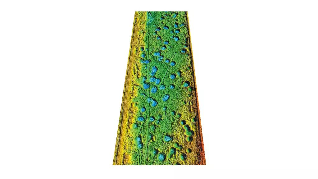
According to a Live Science report, Maria Fajer of the University of Silesia and her colleagues employed lidar technology to record some 6,000 bomb craters in the Koźle Basin, an area of forests and wetlands in southern Poland that was part of Germany during World War II.

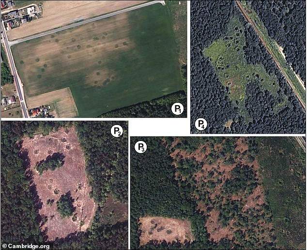
Researchers recently mapped and analyzed the deeply scarred landscape for the first time, counting around 6,000 bomb craters ranging from 16 to 49 feet (5 to 15 meters) in diameter. Some areas held as many as 30 craters in a single hectare (10,000 square meters).
Their investigation presents a grim picture of the damage sustained by the battle-torn terrain, known as the Koźle Basin. But it also offers a glimpse of how the craters have since become an important part of the basin’s natural landscape and ecosystems, the scientists reported in a new study.
The Koźle Basin covers an area of approximately 180 square miles (470 square kilometers). Within the basin, extending for about 60 square miles (150 square km), “there are clusters of remnants of the Allied air campaign conducted there in the second half of 1944,” said study author Maria Fajer, a geomorphology researcher with the Faculty of Earth Sciences at the University of Silesia in Katowice, Poland.
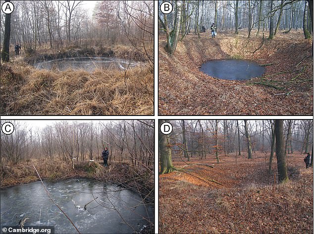
“These are variously preserved bomb craters, ranging from those that are very well visible in the field to traces of backfilled and reclaimed craters,” Fajer told Live Science in an email.
Nazi Germany controlled the Koźle Basin during WWII and used the region for industrial fuel production. It was the biggest such site in the entire Third Reich, the scientists reported. Coal and water were easily accessible there, while dense forests and sheltering hills provided natural cover from air and ground attacks.
Because the basin’s topography trapped air masses, the Germans could add another layer of protection to their operation by producing thick anti-aircraft smoke screens.
Great Britain’s Royal Air Force began targeting the region for the bombing in February 1943, and in June 1944 Americans and British pilots prioritized the destruction of Nazi oil refineries, as well as fuel and chemical factories.
Wartime records describe Allied planes dropping a total of 39,137 bombs in the Koźle Basin. Most of these were delayed-action bombs that were “intended for the destruction of buildings, reinforced concrete, and metal structures, as well as land-cratering,” the scientists reported March 16 in the journal Antiquity.
Uncounted numbers of craters were scoured away during postwar construction and agriculture, and researchers decided to map the region before more evidence of this noteworthy wartime bombardment was lost forever, according to the study.

Scanning with lasers
The researchers deployed a remote sensing method called light detection and ranging, or lidar, which uses laser pulses to peer through vegetation and reveal features in the ground.
By examining the sizes, shapes, and distribution of thousands of craters, the researchers were able to piece together a picture of the types of bombs that were used; how many were dropped at the same time; and ground conditions at the time of impact.
Today, these craters “are relics that document important historical events, and that constitutes a link between the area and the battlefields of Europe and beyond,” the study authors wrote. In the 75 years that have passed since the war, these remnants of violent explosions have gradually become part of the forest habitat.
“They now represent places where many amphibian, reptile, insect, bird, and ungulate species reside, seek shelter, or breed. The craters also provide habitats for numerous plant species,” the study authors wrote.
“The many water bodies and marshes that formed in the bomb craters contribute to the diversification and enrichment of local ecosystems, where sandy soils dominate.”

Follow-up studies by the scientists will further explore the ecological role of craters in forest ecosystems and the threats posed by unexploded bombs, Fajer said.
In the decades since WWII, natural processes such as erosion have erased many of the craters, while industry, farming, and other human activities could wipe away still more. Mapping the bomb fields will therefore help to preserve a record of WWII devastation before it vanishes.
The researchers also argue that locations marred by WWII devastation, such as the still-scarred Koźle Basin, should be conserved for future generations. These areas “should be covered by special heritage protection measures to help us remember the consequences of the bad decisions that led to the war,” Fajer said.


